By Bilal Khan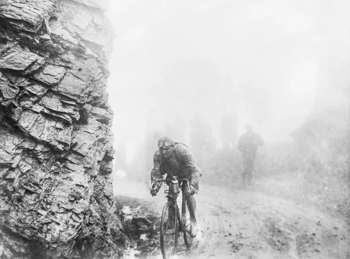
Crafting the Tour de France Course
The process of designing the Tour de France route commences approximately three years before the event. This extensive planning period allows organisers to meticulously select the starting city for the Grand Depart. Following this initial decision, the Tour director determines the overall direction the race will take, then proceeds to choose the departure and arrival towns for each of the 21 stages. These selections are made from a pool of around 300 potential locations, which includes 50 international options.
Several considerations influence these choices. Sporting aspects are significant, with the southern part of France often highlighted for its varied terrain, offering flat sections, medium mountains, and challenging climbs. However, other regions such as Brittany, known for its cycling culture, and the northern areas, which have previously hosted the event with considerable public enthusiasm, are also factored in. Normandy is noted for attracting a large number of fans. The organisers aim to cover various regions over a period of four to five years.
The visual appeal of the route is also a crucial element, as the scenery contributes to the viewing experience for audiences. Special attention is given to stages scheduled for weekends and Bastille Day, France’s national holiday, as these typically draw the largest television viewership. Certain iconic climbs, such as Tourmalet, Galibier, Ventoux, and Alpe d’Huez, are considered essential components of the mountainous stages.
Historical and Practical Route Development
Historical and sentimental factors can also play a role in route design. An example includes the Tour passing through Castelnau-Magnoac, the birthplace of France’s national rugby team captain Antoine Dupont, prior to the 2023 World Cup. In 2014, seven stages largely traced the World War I frontline from a century earlier. This approach allows stages to be interpreted in multiple ways.
Once the 21 departure and finish towns are finalised, the route director takes over to map out the precise 3,000-kilometre path. This phase begins after the conclusion of the Tour in late July for the following year’s event. By the end of August, the list of stage towns is provided, and the route director typically designs the course within a month, aiming for completion by September 25.
The initial design involves using mapping and cycling applications, alongside considering suggestions from cycling enthusiasts. Subsequently, the route director inspects potential problem areas, particularly in town centres, which may contain unexpected hazards like traffic calming infrastructure that could impede the peloton of over 180 riders. After the route is confirmed, the course of each stage is driven by a team of two, who document dangers, layout details, and designate locations for intermediate sprints and climb summits.
The Tour de France route is officially unveiled in October in Paris, nine months before the race commences. Despite thorough planning, unforeseen issues can arise, such as a diversion required for a stage due to a swine flu outbreak. Such last-minute adjustments often necessitate significant effort to resolve.

A Look Back at the 1926 Tour
The 1926 Tour de France stands out in the race’s history for its demanding nature. This edition, which covered 5,745 kilometres, remains the longest and is often described as a battle of attrition. The average length of its 17 stages was 338 kilometres, with one stage, from Perpignan to Toulon, extending to 427 kilometres. Stage 10, from Bayonne to Luchon through the Pyrenees, is particularly noted in cycling lore, having been contested in severe weather conditions.
The 1926 Tour began outside Paris for the first time since its inception in 1903, starting in Evian, near the Franco-Swiss border. The route followed an anticlockwise loop around France, tracing frontiers with Germany, Luxembourg, and Belgium, then along the coasts of Normandy and Brittany to the Spanish border. It then traversed the Pyrenees, moved east along the Côte d’Azur, and headed north along the borders with Italy and Switzerland, before returning through Evian and concluding in Paris.
The race reflected the vision of its organiser, Henri Desgrange, who aimed to promote a sense of French nationhood and encourage physical fitness. He designed routes to reinforce national borders and inspire Frenchmen through challenging cycling tests. The 1919 race, for instance, was routed through Alsace-Lorraine after its return to France by the Treaty of Versailles.
The 1926 Tour saw 126 riders start, with 15 withdrawing on the first day and seven on the second. Many competitors were ‘touriste-routiers’, riding individually without sponsorship. Due to the extreme difficulty of the route, riders sometimes collaborated as a survival strategy, agreeing not to race aggressively on certain stages to conserve energy for the arduous journey ahead. This collective approach occasionally drew strong reactions from Desgrange.
The conditions worsened significantly in the Pyrenees. Stage 10 began before dawn in severe weather, which continued to deteriorate. Of the 76 riders who started this stage, 22 were forced to abandon, including the favourite and defending champion, Ottavio Bottecchia. The Belgian Lucien Buysse won this stage in a time of 17 hours, 12 minutes, and ultimately secured the overall victory.
Read Also
Source: tribune.com.pk